The Youth Publishing House has published a map on Uncle Ho's 30-year journey to seek ways for national salvation, on the occasion of the 110th anniversary of President Ho Chi Minh’s departure (June 5, 1941) to find the path to liberate the nation.
 |
|
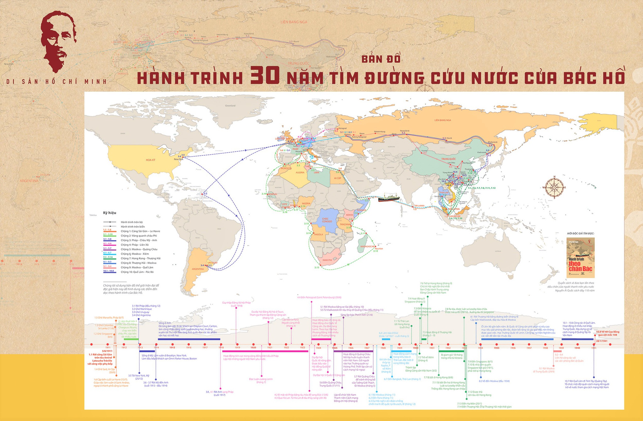
Map on Uncle Ho's 30-year national salvation journey (Source: The Youth Publishing House)
|
The map is 100x70cm in size, geographically detailing Uncle Ho's journey and historical landmarks during his trip, as well as the President’s revolutionary activities from June 5, 1911 to January 28, 1941.
It helps viewers easily visualise, track and look up information about Uncle Ho's journey in connection with the geopolitical context at present.
The map was developed on the basis of a book about President Ho Chi Minh titled “Hanh trinh theo chan Bac” by Tran Duc Tuan, which was also re-published on this occasion./.
BTA